 Topo 1
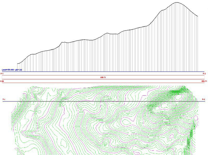
Topo features a series of CAD tools that enables processing of digital landscape, cross-sections and contour lines for land survey works. Topo comes as an AutoCAD add-on and enables drawing of site's TIN, contour lines, cross/long sections and more.
Last update
20 May. 2013
Licence
Free to try |
$100.00
OS Support
Windows XP, Windows Vista, Windows 7
Downloads
Total: 1,174 | Last week: 27
Ranking
#14 in
3D Modeling & CAD
Publisher
Engineering Solutions
Screenshots of Topo
Topo Publisher's Description
Topo features a series of CAD tools that enables processing of digital landscape, cross-sections and contour lines for land survey works.
Topo comes as an AutoCAD add-on and it is not designed to function as self standing software.
Please note that VBA runtime libraries are required by this add-on, therefore an AutoCAD LT version is not adequate for installing and running this add-on.
Some of the Topo's key routines include:
- Draw a scaled grid for plan plotting
- Import points from ASCII (simple text) 3D coordinate file
- Export coordinates to ASCII in Cartesian or polar coordinate system
- Form the Triangular Irregular Network (TIN) of a survey site
- Manual handling and correction tools for TIN elements
- Produce analytical area calculations and draw calculation formulas on drawing
- Produce a cross section of the landscape
- Produce contour lines of the site
Also includes a series of useful CAD tools:
- Scaling tools for raster images and 3D objects
- A series of text manipulation tools
- Distance measurement tool
- 3D object manipulation
Future work on this project will allow an advanced version that allows:
- Volume measurements
- Road design
What's New in Version 1 of Topo
Initial release
Look for Similar Items by Category
Feedback
- If you need help or have a question, contact us
- Would you like to update this product info?
- Is there any feedback you would like to provide? Click here
Popular Downloads
-
 Kundli
4.5
Kundli
4.5
-
 Macromedia Flash 8
8.0
Macromedia Flash 8
8.0
-
 Cool Edit Pro
2.1.3097.0
Cool Edit Pro
2.1.3097.0
-
 Hill Climb Racing
1.0
Hill Climb Racing
1.0
-
 Cheat Engine
6.8.1
Cheat Engine
6.8.1
-
 Grand Theft Auto: Vice City
1.0
Grand Theft Auto: Vice City
1.0
-
 C-Free
5.0
C-Free
5.0
-
 Windows XP Service Pack 3
Build...
Windows XP Service Pack 3
Build...
-
 Iggle Pop
1.0
Iggle Pop
1.0
-
 Grand Auto Adventure
1.0
Grand Auto Adventure
1.0
-
 Ulead Video Studio Plus
11
Ulead Video Studio Plus
11
-
 Zuma Deluxe
1.0
Zuma Deluxe
1.0
-
 Netcut
2.1.4
Netcut
2.1.4
-
 AtomTime Pro
3.1d
AtomTime Pro
3.1d
-
 Tom VPN
2.2.8
Tom VPN
2.2.8
-
 Auto-Tune Evo VST
6.0.9.2
Auto-Tune Evo VST
6.0.9.2
-
 Horizon
2.9.0.0
Horizon
2.9.0.0
-
 Vidnoz AI
1.0.0
Vidnoz AI
1.0.0
-
 Vector on PC
1.0
Vector on PC
1.0
-
 PhotoImpression
6.5
PhotoImpression
6.5